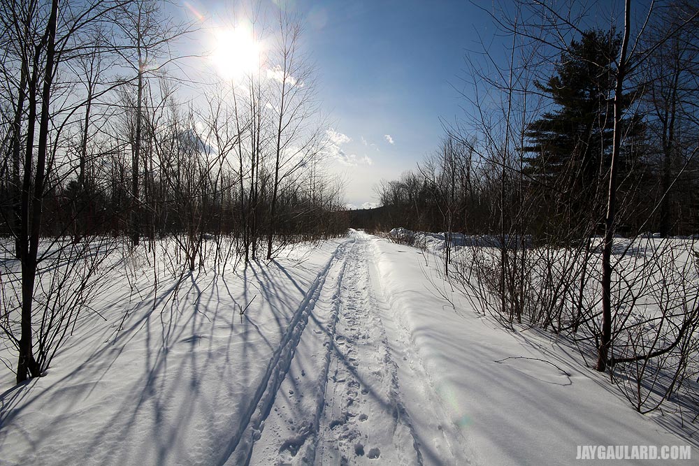
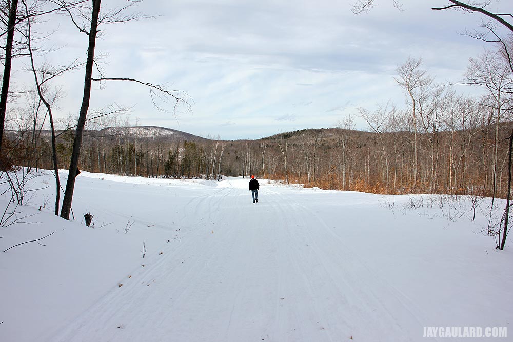
Maine is full of opportunities for hiking in the snow. It’s actually a very common activity in the state. While many people think it’s necessary to use snowshoes to stay on top of the snow, shoes are only really needed when attempting to traverse deep powder. I’d say eight inches or more. Laura and I have only tried hiking in powder a few times and those were for very short distances. Most of our winter hiking has been done along snowmobile trails, where the snow is packed fairly well. As a comparison, our hikes on the snowmobile trails would be akin to walking up a ski slope. Firm sneakers would almost be appropriate. In other words, what we encountered wasn’t very challenging.
Through the years, I’ve written many posts that discuss our adventures in the snow. I’ve also taken far too many photos of the same. Recently, I’ve decided to combine both of these things into one long page in an attempt at better organizing this website. I hope you’ll take the opportunity to read what I have to offer below.
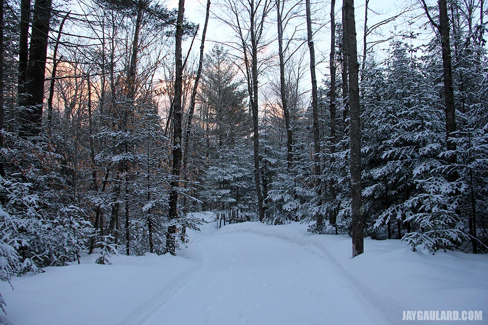
Snow Trail Hiking in Maine
We ventured back out to the trail on Tuesday. It was very cold, but we really didn’t feel it through our jackets, hats, gloves, and boots. And Laura wore her Baffin boots with the studs. She had to pull me up the hill at the end of the hike. I was slipping all over the place. Her studs held well and brought us home.
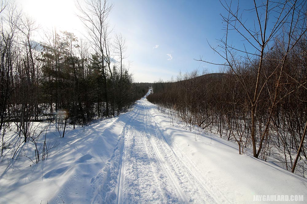
Since this is the same trail we walked last week and since I already gave you the rundown on what it’s all about, we’ll keep this to another walking tour, chock full of pictures. We’ll keep things easy.
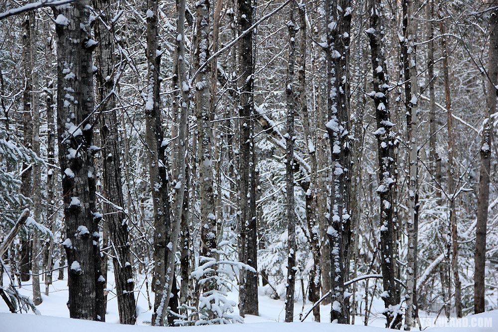
Laura took some of the below photos and I took some others. She used the standard 18-135mm lens and I used the extra wide-angle 10-20mm. You’ll probably be able to figure out who took what by using that bit of information.
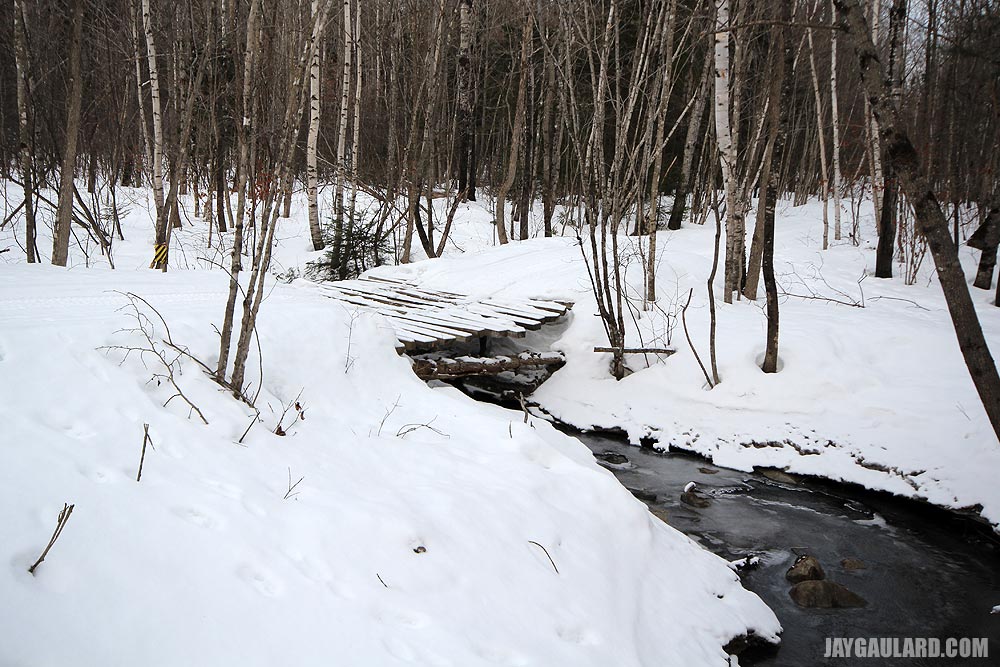
This is the first small bridge I was talking about the other day. The stream leads about a mile down through our back yard. It then turns to swamp and eventually finds its way into another stream and then the larger river.
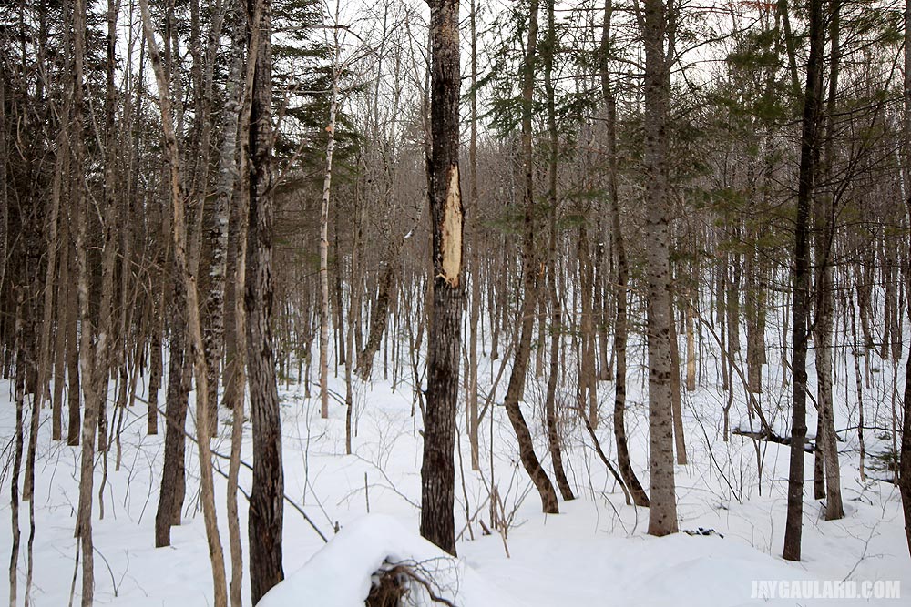
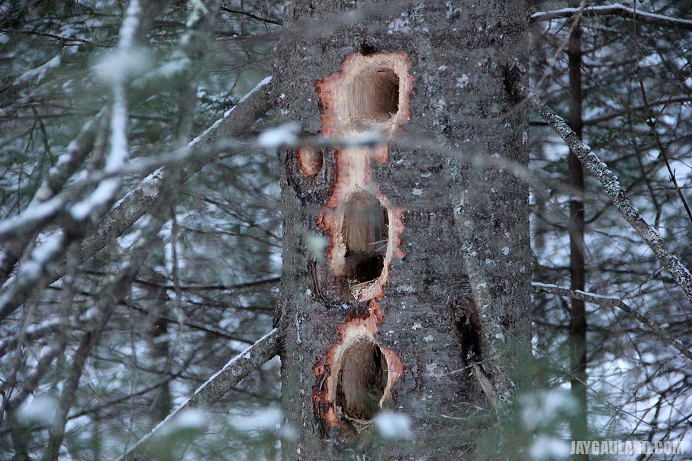
This is what I suspect is a moose rub. The tree damage is about 8 feet high. We can’t seem to think of any other animal that could do that besides a bear scratching. But after doing a few quick searches, I do think it was a moose. And there are quite a few of them (moose rubs, that is).
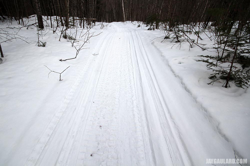
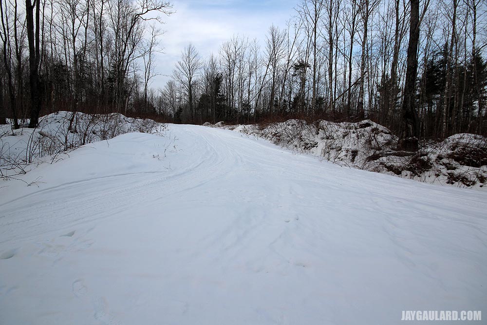
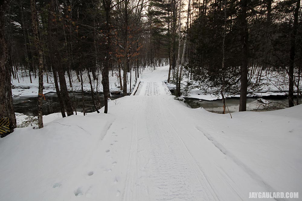
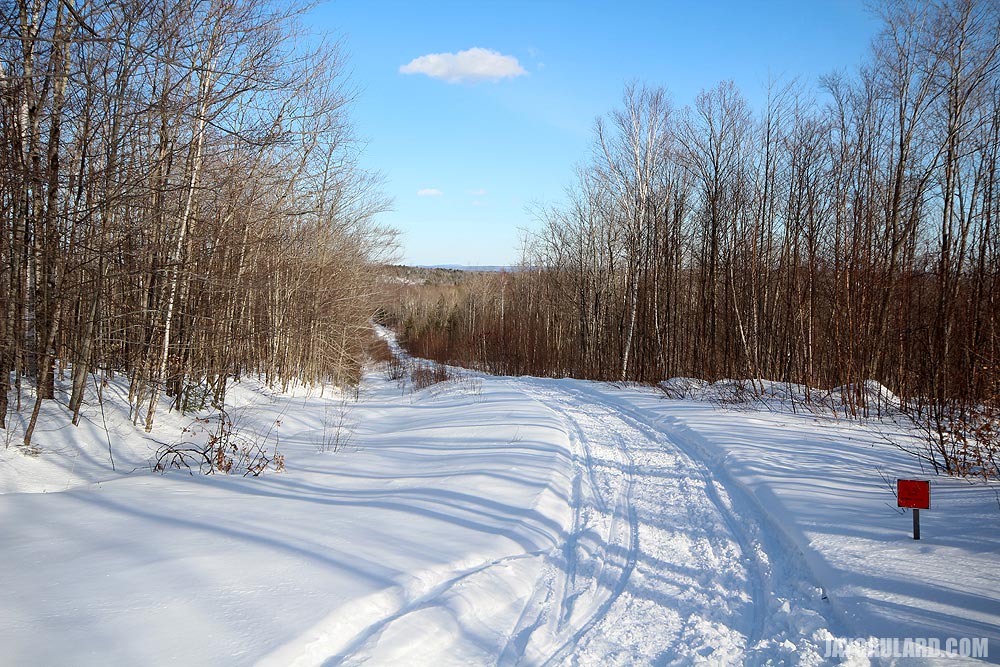
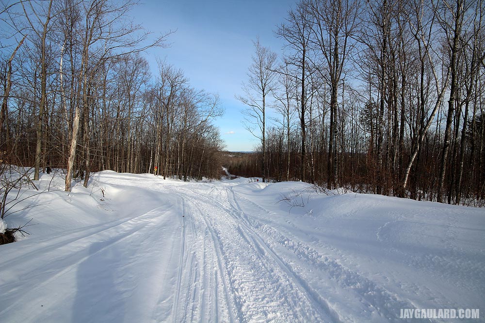
This is the main snowmobile trail that leads to the larger bridge.
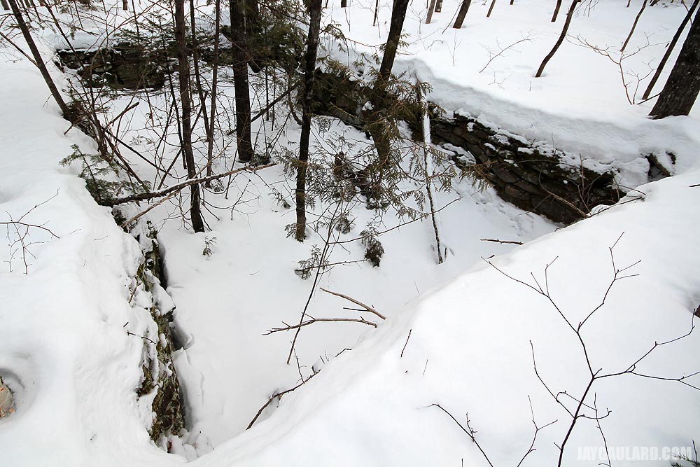
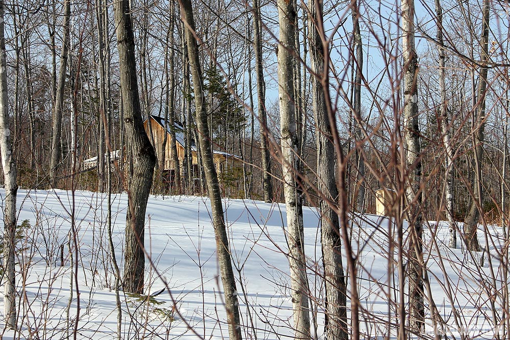
Remember I mentioned there was an old foundation that was made of stone back there in the woods? Well, here it is. I couldn’t really get any great shots because of the snow, but you can bet I’ll get inside that thing once Spring rolls around.
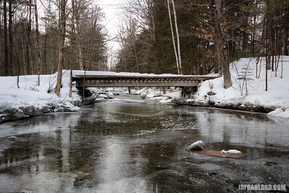
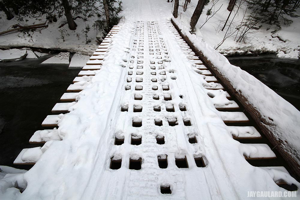
Ah, the bridge I’ve been talking about. It looks as though someone or someones recently did some work to this bridge as shown in later photos. You can still see the tags on the ends of the lumber.
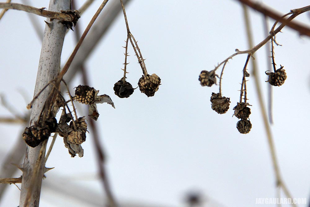
For some reason, we’ve got a whole lot of wild berries that aren’t eaten by the birds around here. In this case, we have wild raspberries.
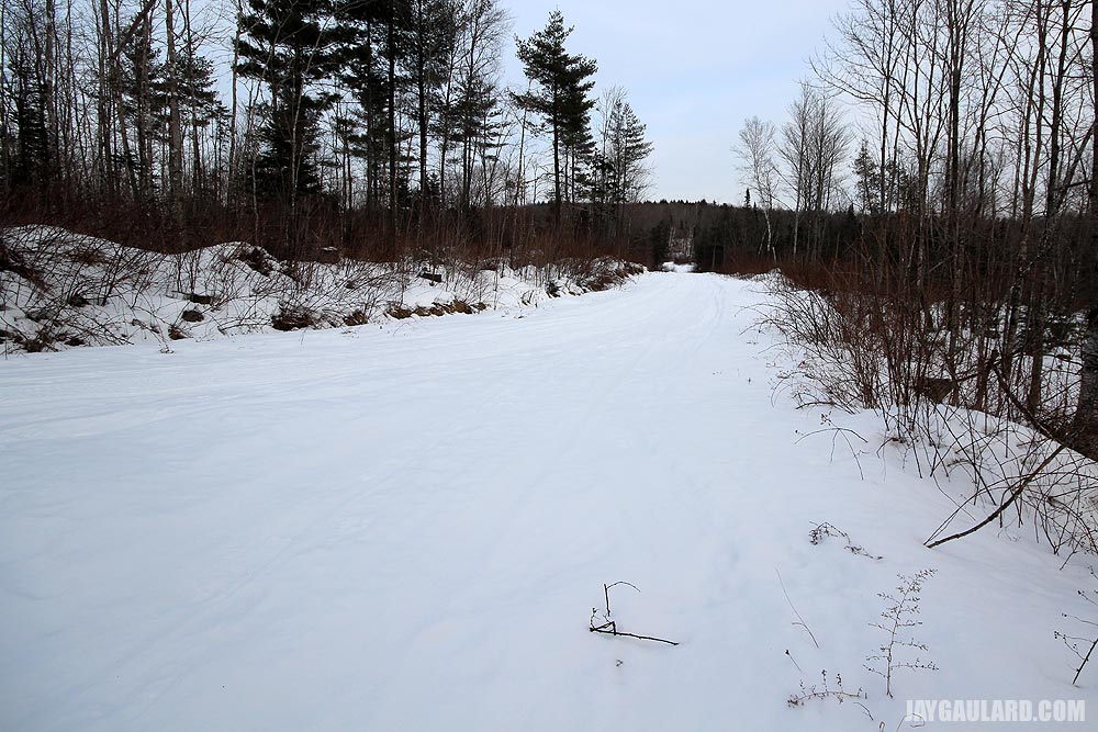
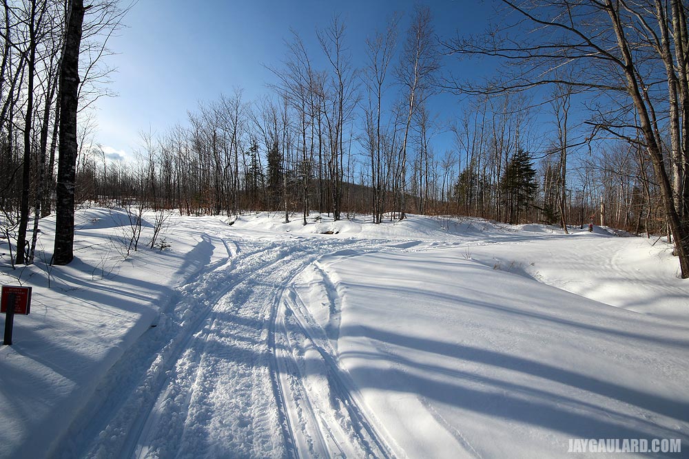
After you cross the bridge, you come out there where the snowmobile trails open up. These are two pictures of the trails heading North and East. My friend at the end of the road owns the land we were on. He owns over 380 acres up here – a mile this way and a mile that. What a huge amount of land for us to play on.
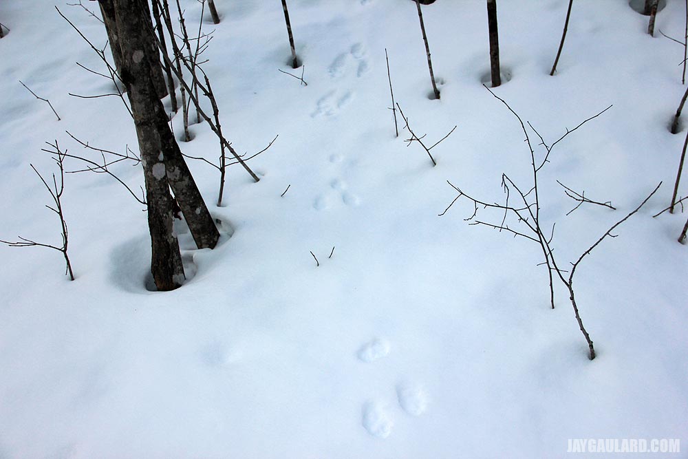
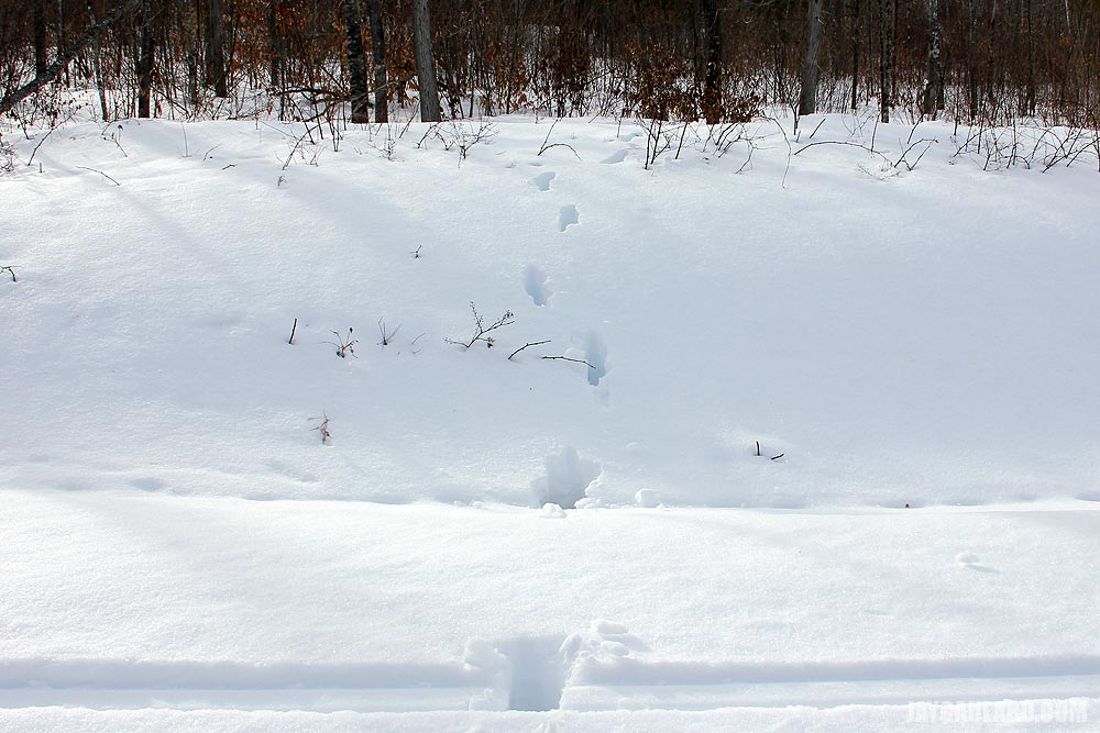
These are rabbit tracks through the snow. Laura seems to think these are snowshoe hare tracks. I took a look at comparable pictures and agree.
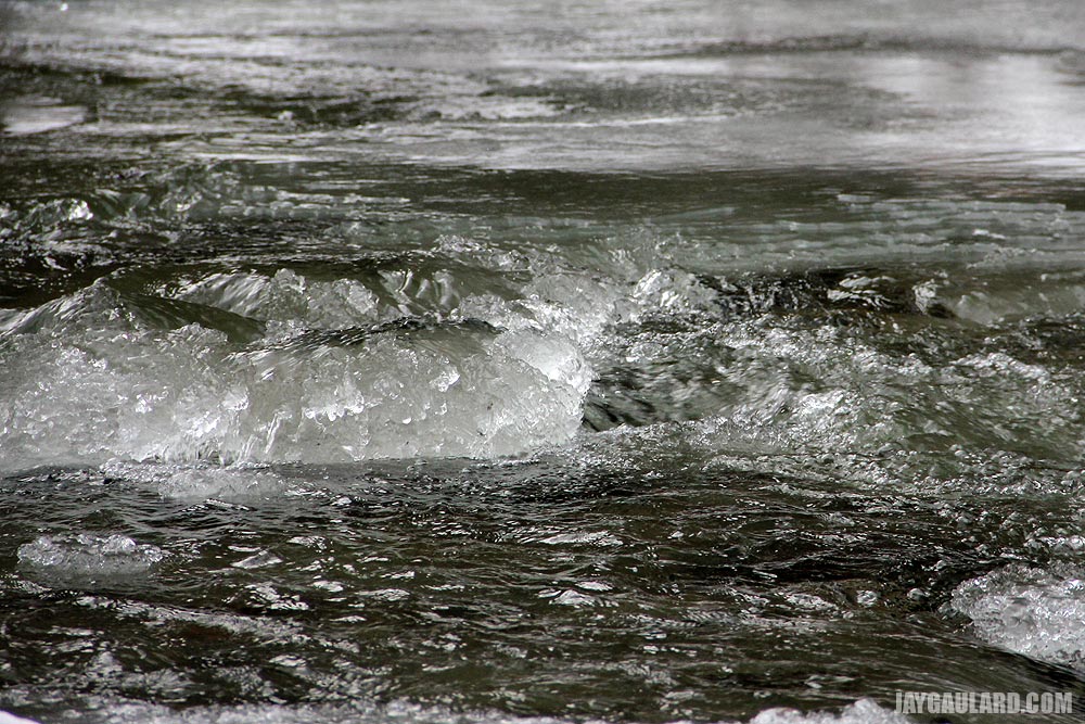
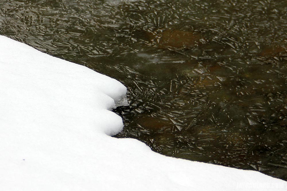
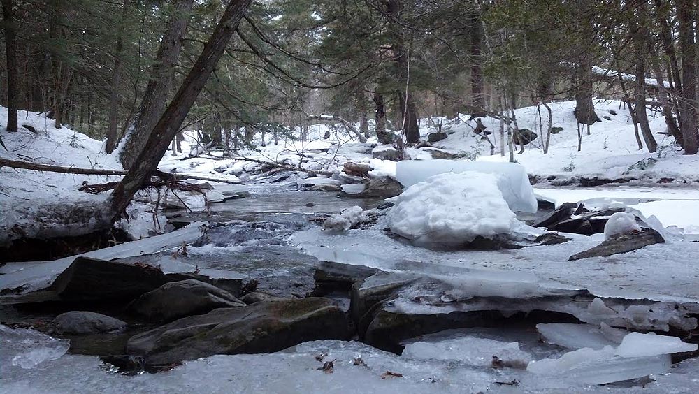
Some of the river was frozen while other parts were not. In this case, the water was flowing enough to give Laura and chance to take a picture of it. And just to let you know, the cloudiness in the water from all that rain has disappeared. The clarity is back, as I’ll show you in just a bit.
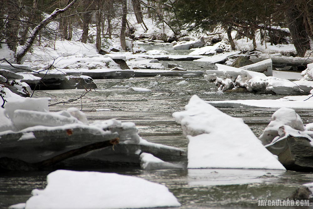
Obviously, the river water was much deeper last week when it froze. Now that the level has dropped, all the ice cracked and sits in chunks. It sort of looks like Krypton from Superman.
There were areas of ice that had some interesting texture in it. All I can think of is that the ice melted some and then re-froze, creating this.
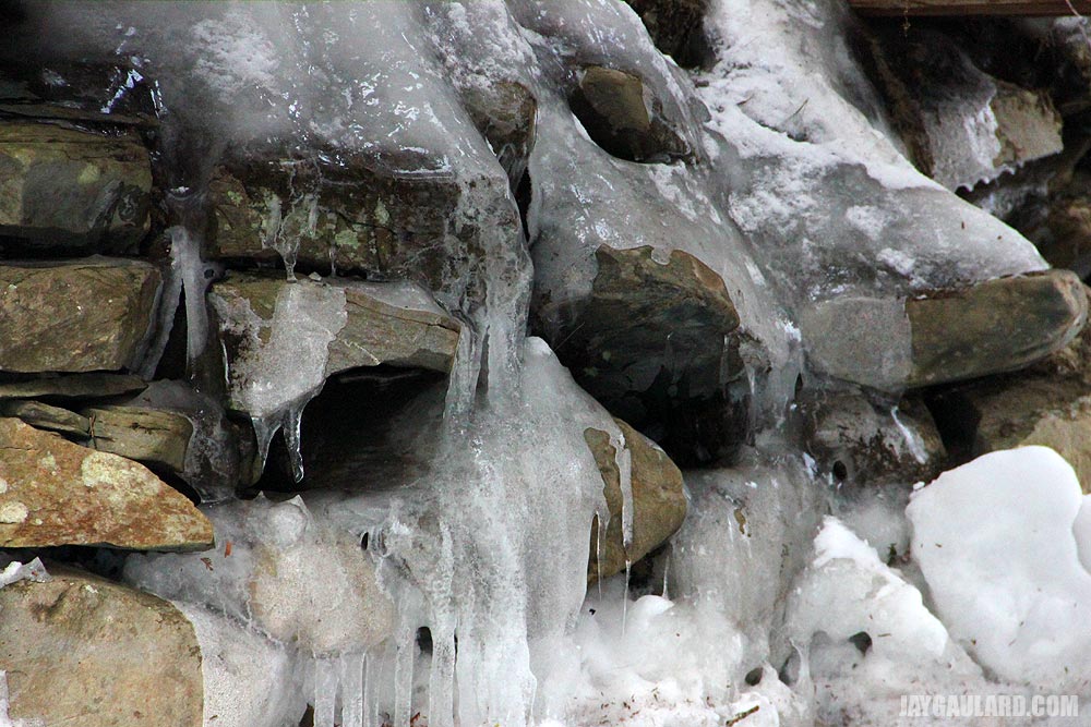
The area under the bridge is made of stones. Water came through those stones and created icicles.
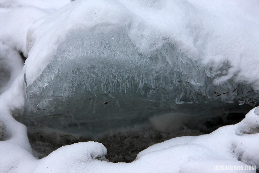
Here’s another example of something interesting that happens when water freezes. It’s a chunk of ice at the side of the river. This time, there are veins running through the ice.
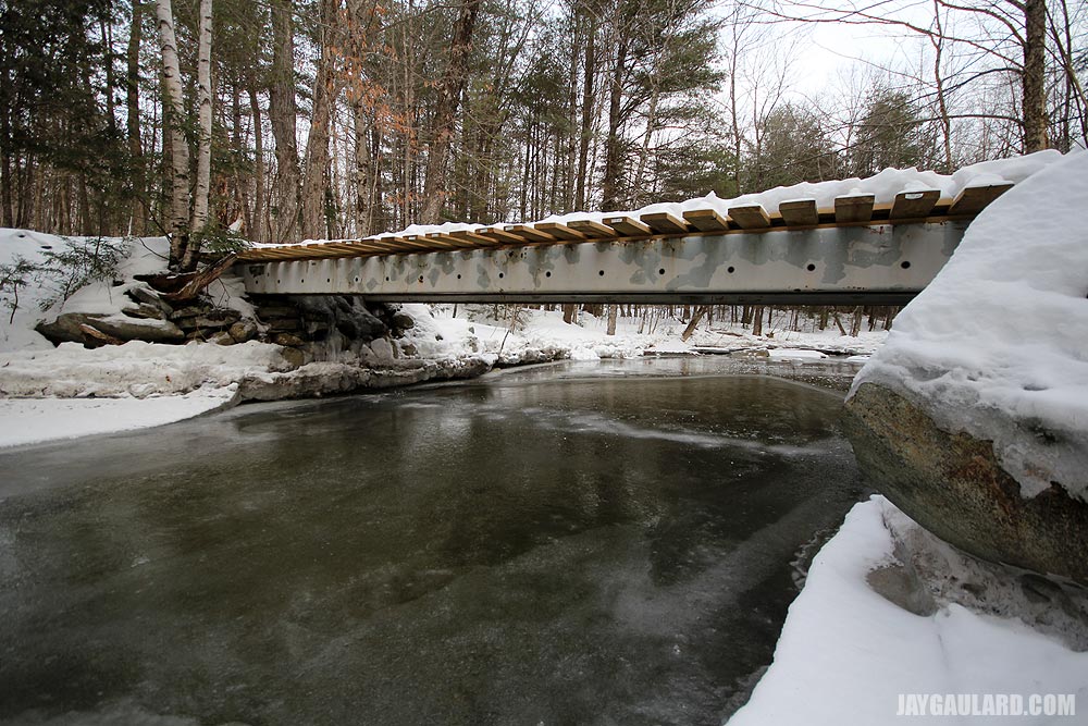
This is the other side of the bridge. Like I mentioned before, you can still see the tags on the edge of each piece of lumber.

Yes, the clear water came back and here’s the ice to prove it. Can you believe it? The river is about a foot deep here and I was looking straight through the ice as small bits of wood and leaves tumbled by.
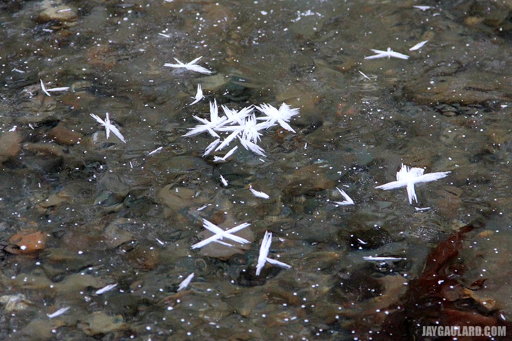
I’m not sure if these can be classified as snowflakes, but they were snow something. Strange things too. They were large and somewhat bulky looking.
Say goodbye to the snowmobile bridge because in just a few short months, this will become the ATV and hiking bridge. Miles and miles of riding and hiking.
The Mother of All Trails
Laura and I went for a walk up the road today. We usually get to the end, turn around and come back. Today though, our intention wasn’t to turn around, but to head down one of the snowmobile trails to see exactly what was going on. A buddy of mine, who lives at the top of the road, told me that he and his wife have three walks they take – a two mile, a six mile and a seven mile. We know the two mile. That’s just down the road and back. We have no idea what the others are and that’s kind of why we wanted to head down the trail.
The river that runs along the back of our property also runs parallel to the road we live on, so if we were to walk to the top of the road and make a right down the trail, we’d have to cross the river. I can’t really see what’s going on down there on Google Earth and have been wondering how in the world these snowmobiles have been getting by. I’m aware that the trails are maintained by snowmobile clubs, but really have no knowledge of anything beyond that.
Boy were we in for a surprise. First, we found that you can totally walk on snowmobile trails. The snow is packed and it’s not like walking in the back yard. That was a huge plus. We’ve been avoiding the area because we thought we’d have to trudge through and lose all interest after a short while. That wasn’t the case.
Second, about a quarter mile in, we found an old house foundation made of stone. I’d say it’s about eight feet deep. It’s really interesting, so we’re going to focus on that at a later date. Third, right after the foundation, we crossed a small bridge that spanned a tiny stream. I thought this stream was the river that ran along the property. I thought that since it was a mile up-stream, it was smaller. I was wrong.
Just a short distance past the stream, we started hearing rushing water. I thought it was cars driving on a road, but quickly remembered that we were in the middle of the woods. There were no cars. We walked a bit further and found this:

What we didn’t know was that the snowmobile trails didn’t only cross the finely crafted larger bridge, they also ran up along the river heading towards only who knows where. Here are two pictures of that:

The only bad part was that we didn’t bring the camera. I had to take these with my phone, so they kind of stink. The sun wasn’t out anyway, so any pictures we did take with the cameras wouldn’t have looked very good.
We’re going to go back this week, or the next time it’s sunny out. The weather forecast is telling me the sun’s supposed to shine on Wednesday, but it’s also supposed to be 3 degrees. I’m not sure I can do that, but we’ll see.
As you can well imagine, we’re pretty excited to live so close to something like this. It feels like a big state park with all those Hemlock trees. And the trails to everywhere – that’s just something else. I can’t seem to “wrap my head around” it and I’m not one for repeating sayings like that.
Hiking a New Snow Trail
We were fortunate enough to enjoy the company of Laura’s brother this past weekend. He came all the way from New York up to Maine to do a little hiking and to visit a sugar house with us for Maine Maple Sunday. I’ll talk about the sugar house in my next post. Right now, I’d like to tell you about a new and magnificent snow trail we discovered while showing off our “luge” style trail that leads down to the river and bridge.
We brought Laura’s brother down to the bridge. There wasn’t much visible water running because of all the snow and ice, but there was a nice gusty breeze rolling through that knocked most of the snow off the large pines that covered the trail (while we were under them). As the wind came through, it felt as if we were stuck in some sort of a blizzard. This made things exciting during our hike.
I think the plan was to show him only the river and bridge. But as we hiked and after we spent a few minutes down at the bottom of the trail, we agreed that following the river up along another trail might be fun. We still had some sunlight and we pretty much knew where we were. If we got lost, we’d backtrack all the way to my truck. Luckily the entire trail turned into a big loop and brought us back there anyway.
I am going to post a few pictures below, but I want to tell you that this trail was the closest looking thing to Narnia that I’ve ever seen. I’m guessing it was because of the recent snowfall clinging to the tree branches. That, along with the powder on the ground and the time of day made it…how did she explain it? Ah, “magical.” It sure was magical back there and I can’t wait to show our other friends what we’ve found. Enjoy the pictures. (PS – hiking in the snow is really fun.)
The first two pictures are of parts of the trail we hiked. As you can see, the conditions were right for a good time.
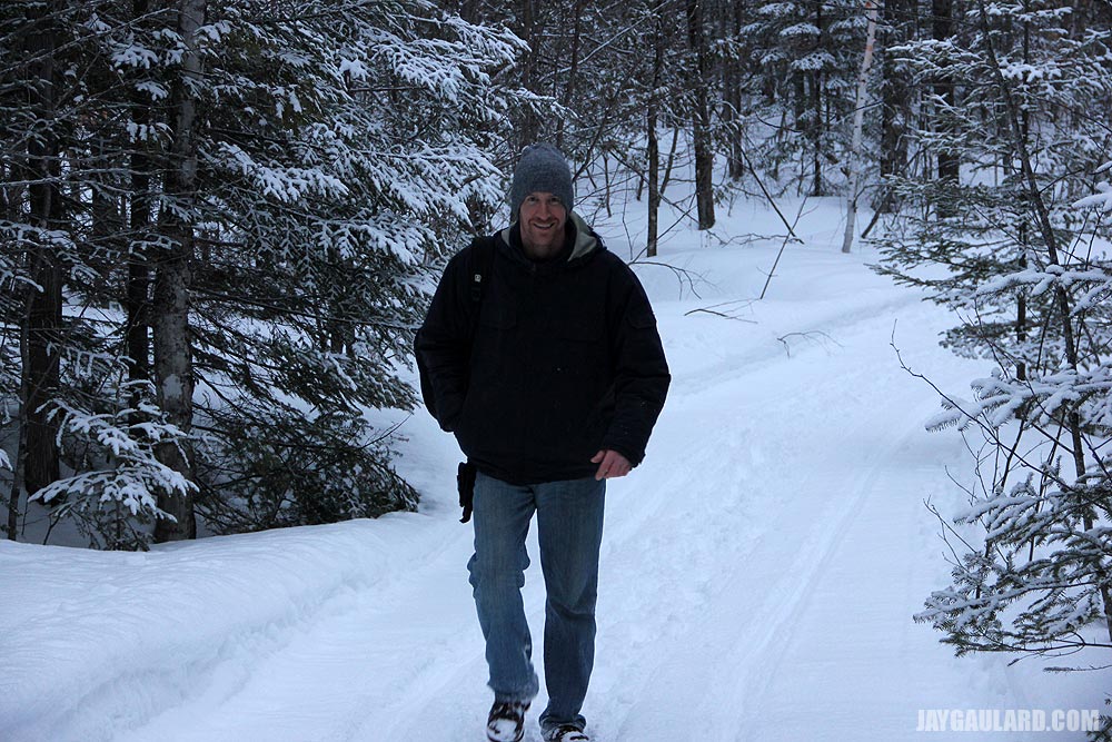
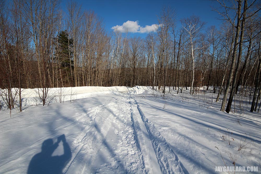
If you were curious, this is what I look like when I walk through the woods.
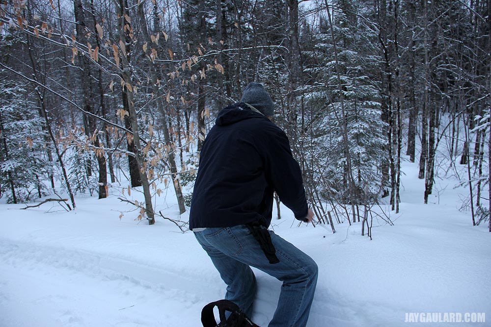
I recently purchased a huge survival knife. I like to wear it on my belt when I go hiking. I’m thinking that it’ll help protect us from a moose. In the case below, I’m demonstrating my knife’s ability to chop down a tiny tree. I got half way through when the little tree fell over and tore in half. What a knife.
Maine Winter Hiking Over the Bridge & Through the Pines
In my opinion, winter truly is the best season. Hands down. Fall is a close second, but winter really has so much to offer. During my years growing up, I never saw it that way, but I sure do now. The reason I wasn’t very fond of winter while I was young is because it got in my way. I needed to do things and I had places to go. Shoveling snow wasn’t much fun and freezing for most of my life was much less fun. Today though, things are different. Well, shoveling snow is still pretty awful, but at least I have a snowblower. Although, my driveway today is a lot longer than the one I grew up with, so I may have to call a draw on this one. And although I still freeze, at least I do it on my terms. As a matter of fact, just a few minutes ago, I was outside in the garage cutting a piece of wood with my handy dandy bow saw. My fingers were frozen to the bone because it’s only about 5 degrees out there, but it’s something I chose to do. If my father asked me to do that when I was younger, my poor parents would never have heard the end of my complaining. Isn’t it strange how these things work out?
Anyway, what I’m getting at here is that perspectives change as one ages. What once used to be terrible isn’t so bad anymore. And when one begins to appreciate certain things, one’s life can improve dramatically. I’ll use a recent hike as an example. When I was a kid, I most likely wouldn’t have wanted to walk a few miles into the woods on a freezing cold day. Today however, I look forward to it. Again, it’s strange how these things work out. Although, I will tell you that I didn’t grow up in Maine either. Perhaps if I lived where I do now when I was a kid, I would have appreciated nature more. Who knows.
Since it’s been pretty sunny lately, Laura and I decided to visit a trail we’ve gone to once or two before. The very first time we stepped foot in this area was during the summer. We only walked about a half mile before saying, “Okay, this is pretty good. We’ll come back.” The next time we went, there was a bit of snow on the ground, but there were some huge puddles that were fairly challenging to walk around. It was also hunting season, which freaked me out a little. Even though we were wearing orange, I still don’t trust some of these hunters. I don’t even trust them when it’s not hunting season, so that’s saying something right there. Yesterday, we went back for the third time and it was magical. I have fallen in love with the area because it’s just so “Maine.” It’s absolutely silent and stunningly beautiful. And it was all ours. There’s never anyone around to bother us. We can walk and explore and do whatever we want, not having to worry about other hikers to contend with.
We walked about two miles yesterday. It was an easy walk, so I took a few photos along the way. I like to stick my camera in my backpack just in case I might need it. During yesterday’s hike, I took some pictures and some video. The pictures are really nice, but the video is extraordinarily boring. I only took it to give you a glimpse of what the area was like. One of these days I’ll actually talk during a video, which I’m sure will add an entirely new dimension to things. Here are the photos I took.
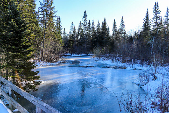
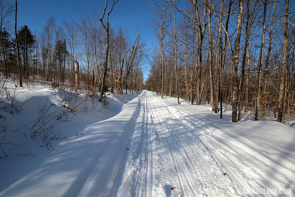
This first one is of the main feature of the trail. The entire trail is about two and a half miles long and this small bridge is about a half mile from where we parked the truck. This bridge is primarily used as a snowmobile and ATV crossing. The stream it crosses was enlarged substantially by a beaver dam just a short distance away.

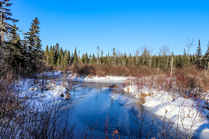
I took this photo as I was standing on the bridge, pointing my camera in the direction of the beaver dam, which you can’t see.
This is the other side of the stream. In the previous shot, I was facing west and now I’m facing east. Just look at the tops of those pine trees. I love those things. By the way, loggers just cut some of the forest beyond those trees, so it would be the perfect time to scoop some of this land up to build a dirtbike track. That’s all I think of these days. Buying 100 acres to build a dirtbike track. There sure is enough land around here to do that. And no one would even care either. People ride ATVs all day long in this area.
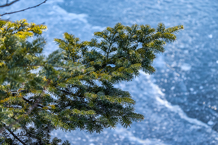
I thought I’d get creative and take a photo of a pine branch that was hanging over the ice. I enjoy shots like this. Just wait until you see the next one.
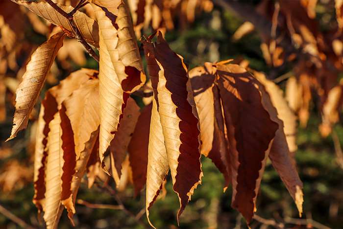
Okay, here we have a random picture of some dried Beech leaves. These leaves stick around until spring when the new growth pushes them off the tree.
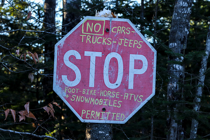
I’m thinking this sign was posted at the edge of one person’s land. Signs are all over the place, telling people what’s allowed and what’s not. It’s best to respect the landowner’s wishes because they can just as easily post the property as no trespassing.
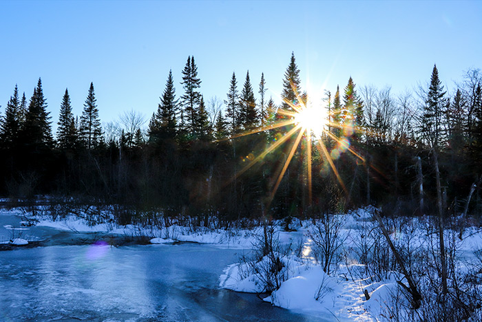
And finally, I have a picture of the sun through the trees. The real reason I took this photo was because I wanted to see if I could get a starburst effect with my lens. To get this, I used aperture priority mode and I cranked the aperture to f/22. Anything over f/11 (I think) will give this effect. Pretty neat, isn’t it?
If you ever decide to go hiking on a cold day in the snow, remember this: there are no bugs, there’s no sweat, and the weather is fine. So much better than the summer. Also, the key for a comfortable walk is in the boots you wear. You need to get some winter hiking boots. These look just like regular hiking boots, but they have extra thick soles and are insulated. I have a pair and my feet were toasty warm.
Here’s some extra special video for you. Lots of crunchy snow walking.
Winter Snow Hiking in Maine
Looking at Land in Maine’s Backcountry
Today, Laura and I accomplished a task that has been on our agenda for some time. We’ve been meaning to get up to the end of the road and hang a left instead of a right. As you already know, taking a right down into the woods brings us to the river and the bridge. Taking a left brings us into a wide variety of logging roads, turned snowmobile trails in the Winter and dirt access roads during the other three seasons.
I have a buddy who’s interested in some land. The parcels he found just happen to be located at the end of our road, up towards one of the numerous mountains in the area. And actually, the land is right at the foot of the mountain, which makes for some pretty decent views.
Today was warm and sunny. I’d say it was about 40 degrees. The trails were packed down nicely and weren’t all too terrible to walk on. Getting up the hill brought on a bit of sweat, but otherwise, things were good.
Just to let you know, the land we looked at today is what some new age folk term, “off the grid.” A few years ago, it was called, oh I don’t know – land. But now, off the grid has joined the ranks of sustainable, organic, green and carbon footprint. Back in the day, those things were just called, “growing stuff.” I’m not sure why I mention this. I suppose it’s because I needed to fill you in on the fact that there is no electric power back in these woods and vehicle access is restricted to any time but Winter.
For my buddy, I’m going to post each picture and then give a description below. And just to let everyone else know, the land back there is magical. There are miles and miles of walking trails and to build a cabin and live off the land would be just short of what man was put on this green earth for. We don’t require much. Just to have our backs to a mountain and our faces look out over the great state of Maine. Ha!

This is the end of our road, looking into the trail. The corner property is 5/8 of a mile up the trail.
Right after I took the first picture, I turned around and took one of the road we just walked off of. See those power lines? We won’t be seeing them for long.
I took these pictures a bit further into the trail. We’re just climbing up what I wasn’t expecting – an incline.
We reached the land. This is the corner lot with the camp on it. I have more pictures of this below. The trail to the right runs north and the trail to the left runs west.

This is a better view of the trail running north. I have another one too.

This is the trail that runs west and that continues up the hill. The camp is on the right.
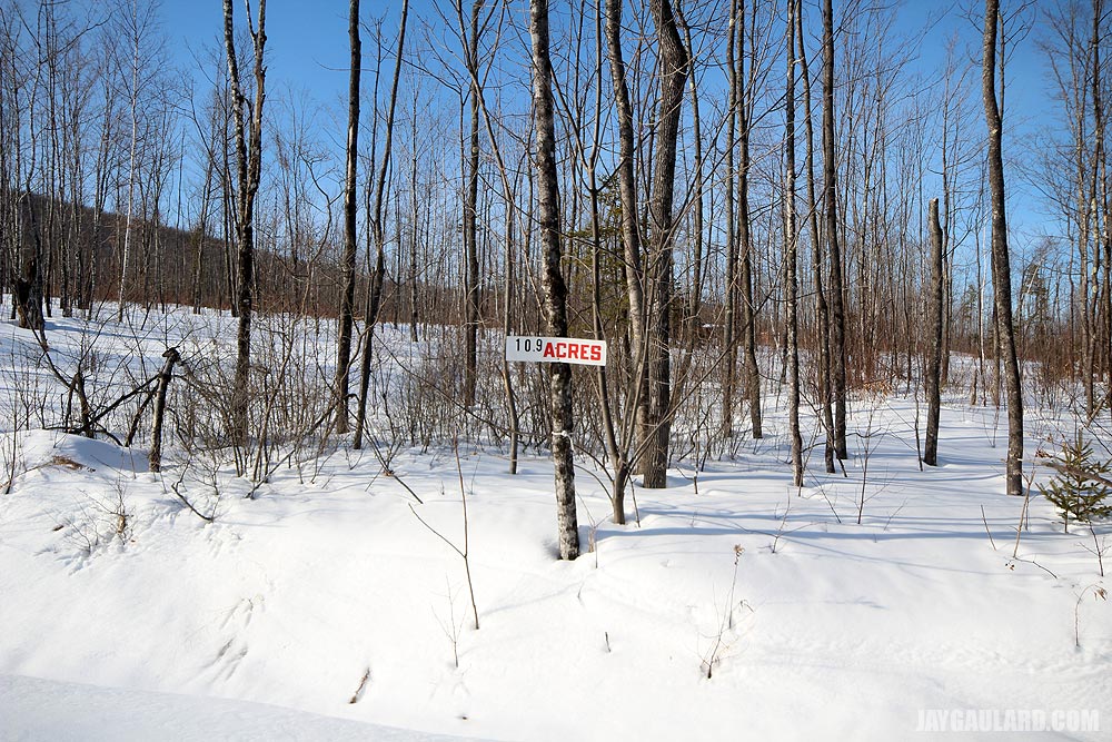
And again, a better view of the trail running north. The lots for sale are all along this trail. I think they’re two acres wide by six acres deep.
This picture was taken as I was standing at the intersection and looking back down the hill. There’s a better picture of the view down below.
If you look closely, you can see the cabin to the right of the sign.
This cabin isn’t for sale. This is located further up the hill and more west.
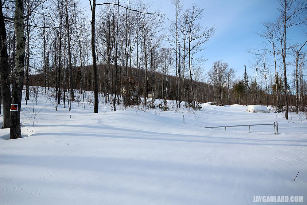
This is the driveway of the camp for sale. It’s under a few few of snow. Sorry about that.
Just looking back east at the intersection from up the hill. The camp is on the left.
This is the best we could do. The camp is very difficult to reach without snowshoes. I tried to walk up the driveway and fell in.
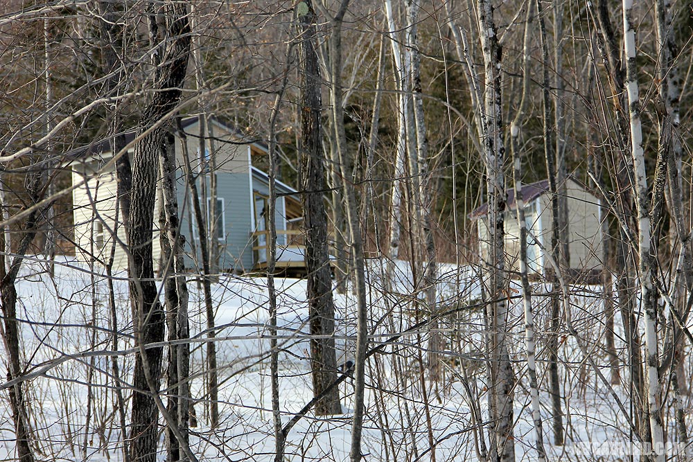
Here are two more cabins further west. I don’t believe they’re for sale. Pretty sweet though. These guys have the right idea. Do you know how far back this is? Not a sound of civilization can be heard.
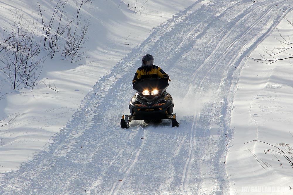
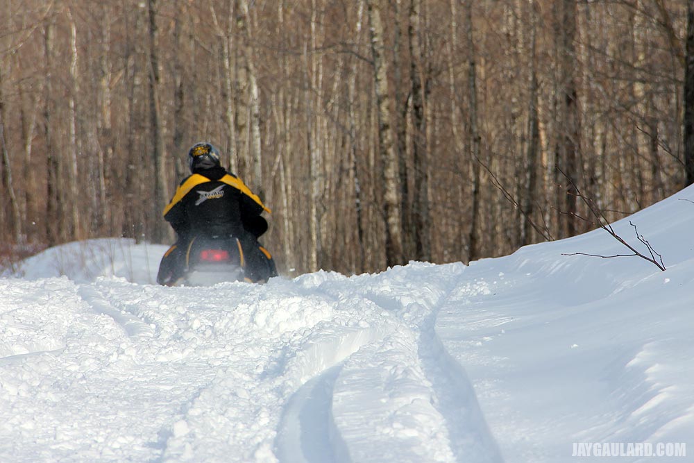
While we were up there, a guy on a sled passed us by. We waved and took his picture. Then, he stopped and asked us if we were alright. Nice guy. He was probably just wondering what in the heck we were doing back there.
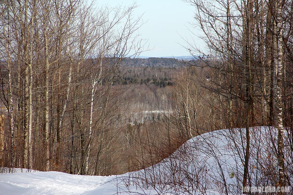
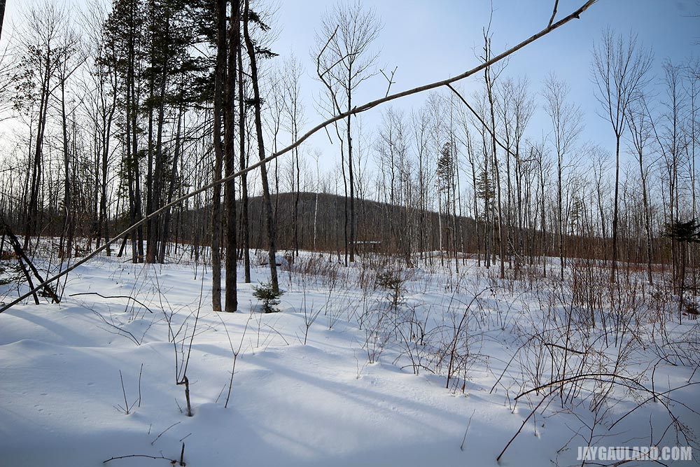
I marvel at marvelous things. This is the view from up there.
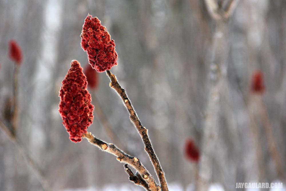
This is a wonderful shot of Sumac. The trail was also lined with wild Raspberry bushes. A whole lot of them.
Well, that’s it. Did you enjoy? I hope so. Personally, I’d love to build a cabin up there and live off the grid. It’d give my life a bunch of meaning. I think you have to be “one of those people” to understand why someone would want to do something like that, but take my word for it when I tell you, it would be worth every minute.
Moose Tracks in Snow Country
Since we arrived in Maine, we’ve had a sort of obsession with sighting a moose. We don’t want to necessarily bump into one while walking on a trail, but we sure would like to see one. As we are well aware, moose can be aggressive and unpredictable, so seeing one from afar would be fine with us.
Yesterday was a really great day for hiking in the snow. This past weekend’s temperatures were in the 40s during the day and 20s and 30s at night. This allowed for some snow melt and re-freeze, which was perfect for staying on top of the deep snow. Walking in the snow is difficult enough, and adding just one extra inch of softness beneath the foot can really break a day.
Ever since we took the hike up to the base of the mountain to look at the camp the other day, we’ve been interested in seeing what else is up there in the woods. I’m constantly on Google Earth trying to plot our next trip. Yesterday’s plan was to simply go a bit further up the Northern trail until we hit the river, look around a bit and then turn back. What we discovered after hiking for about an hour was a trail that was much longer than anticipated. I made the decision to go all the way, meaning continue through the whole 3 1/2 mile loop that would bring us back to our road. I have to say, I’m glad we didn’t wimp out because the scenery up there is stunning. I’m still in disbelief that this type of terrain is in our back yard. Literally, a few minutes on an ATV would bring us smack in the middle of endless trails for hiking and riding. And by endless, I mean that we could walk to Canada if we wanted to.
I’m going to post a few of yesterday’s pictures below. Take particular notice of the moose tracks we found. These tracks were ultra-fresh. I’m guessing the moose crossed our path just a few minutes before we arrived, judging by the condition of the snow. What a sight that would have been. A little freaky, but still cool.
Also, I do want to mention that being a few miles in the woods without another human soul nearby can be a bit unnerving. As much as I like to think I’m a rugged mountain man, I have to confess that there is still some getting used to the whole thing. The silence is awkward and just the fact that there’s no one to call if something happens can get to me. Needless to say, I pay close attention to my surroundings and am very careful where we go and what we do. For future hikes, I plan on being more equipped to defend against an animal that is either protecting its territory or looking at us as its next meal.
Enjoy the pictures.
This was the area we first began taking pictures. As soon as we came over the ridge, I was like, “Whoa.” And to think, we weren’t even planning on bringing the cameras. I wasn’t expecting to see mountains or diverse terrain.
Further down the mountain a bit was where we saw the moose tracks cross the snowmobile trail. It was shocking to say the least because I just assumed the local moose stories to be folklore.
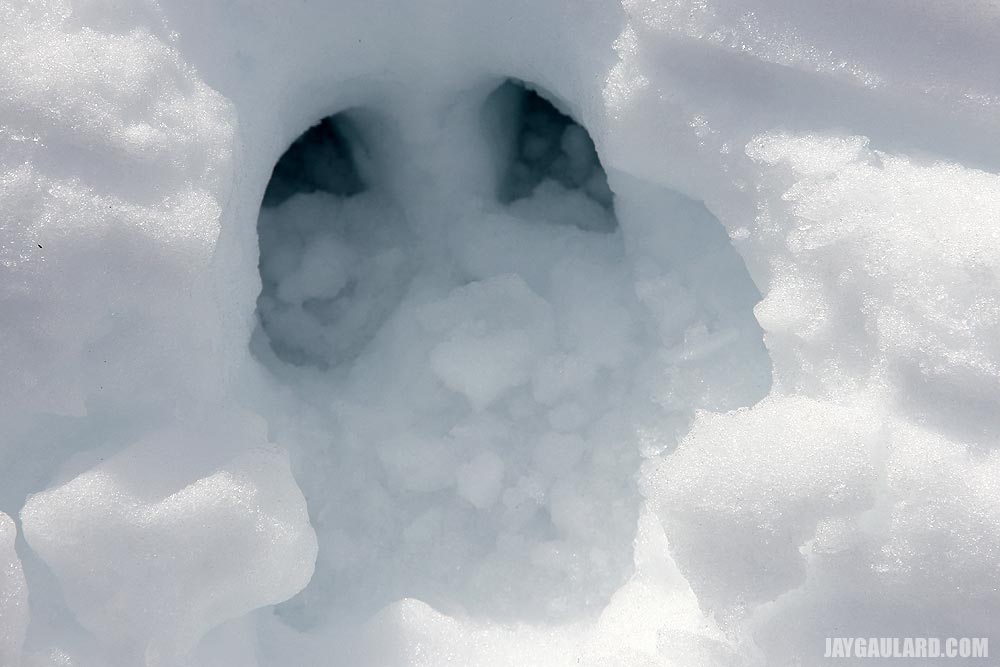
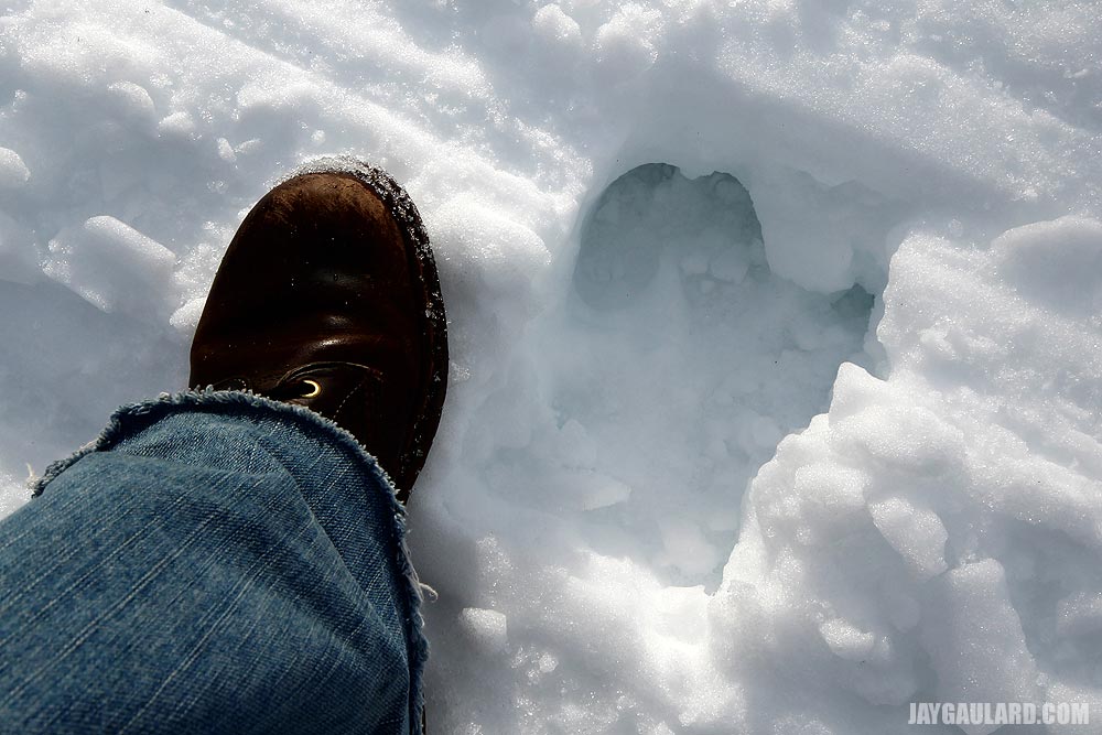
These are pictures of a moose print. When we first took a few pictures, they looked big to us. Then, I realized there wasn’t a comparison picture, so I decided to use my foot to show you how big the print actually was.

This is a ridge that leads down to a valley where the river crosses the trail. Right before the river, we made a right to continue around the long loop.
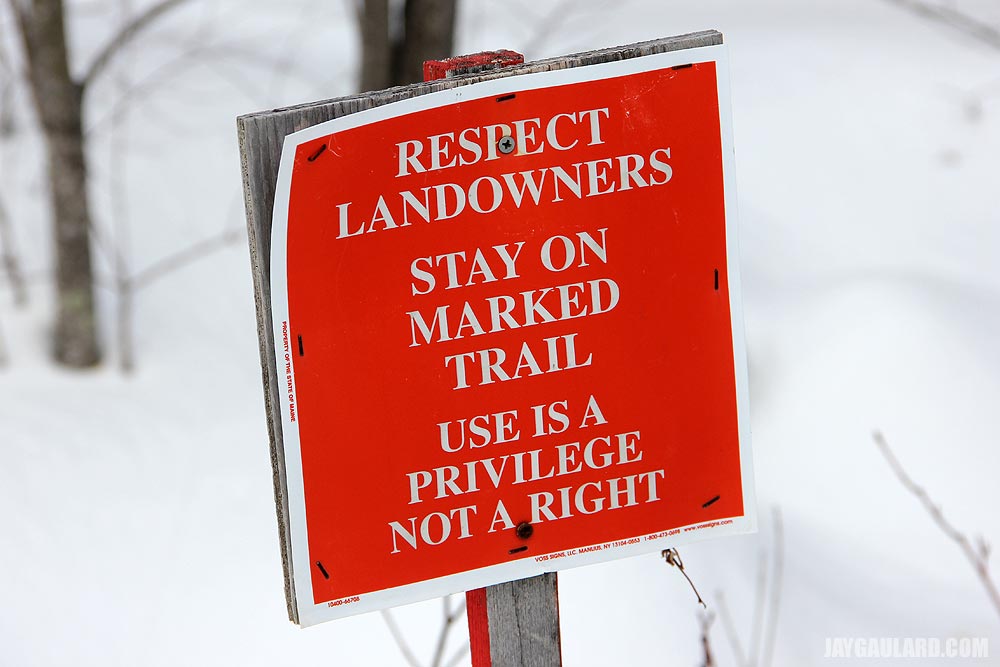
These signs are usually placed before and after a bridge that spans a small river. It’s just a reminder for riders to respect the fact that the landowner’s are allowing them to ride through their property.
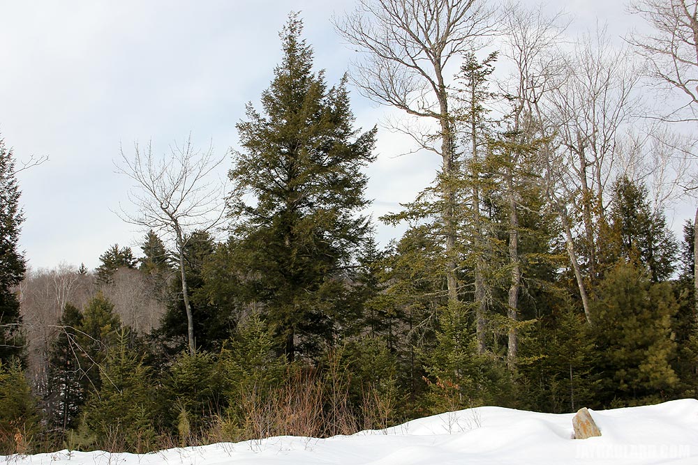
Pine trees began accumulating in the valley close to the river. If there was more sun, I would have taken more pictures of the area because it truly is beautiful.
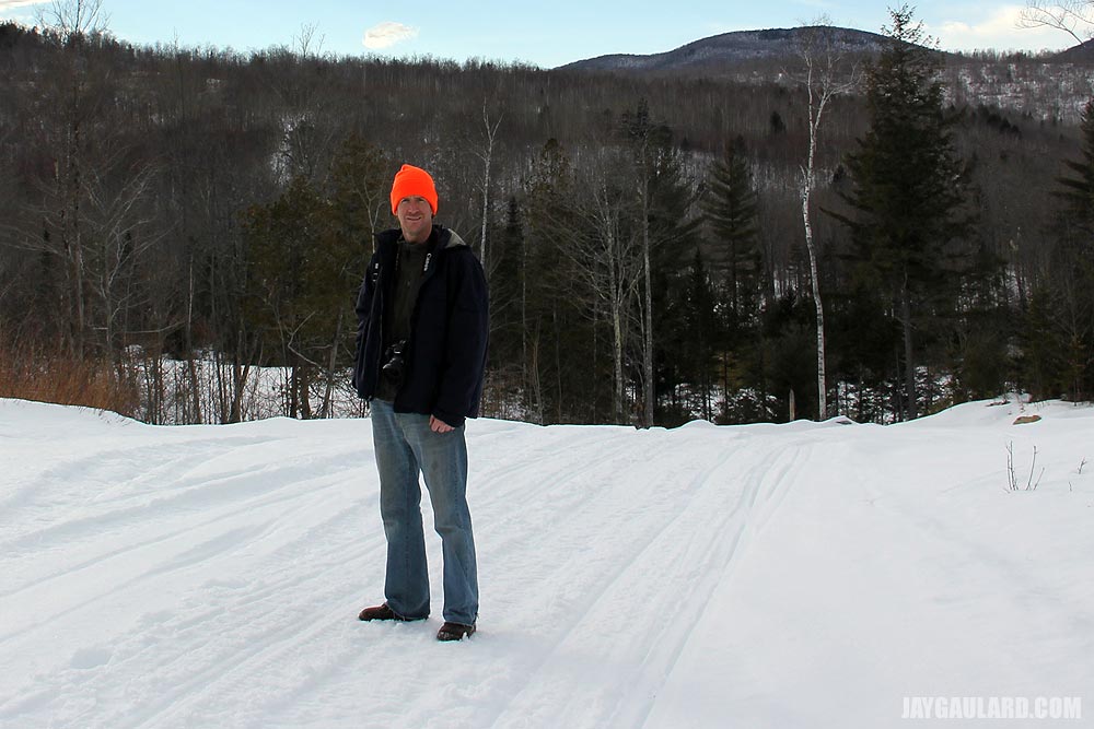
Laura took this nice picture of me modeling on the edge of the valley. This one is a keeper.

The sun and clouds were doing strange things yesterday and offered some unique shots.

This is the beautiful valley I’m talking about. Kind of hard to believe I can walk out our front door and hike there in less than an hour.

Towards the end of our hike, we passed a small area that held oddly spotted Maple trees. It was a small area, which made for a nice picture.
Leave a Reply